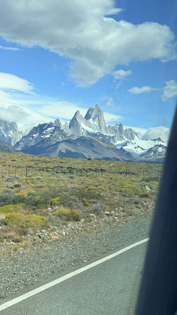
South
Perito Moreno
Via El Calafate
- Tour length8 hrs
- At the glacier3 hrs
- BoatOptional
Guides
Language
Currency
Look up datesfrom $117 · free to cancelYour stop on the map
See 26 route stops
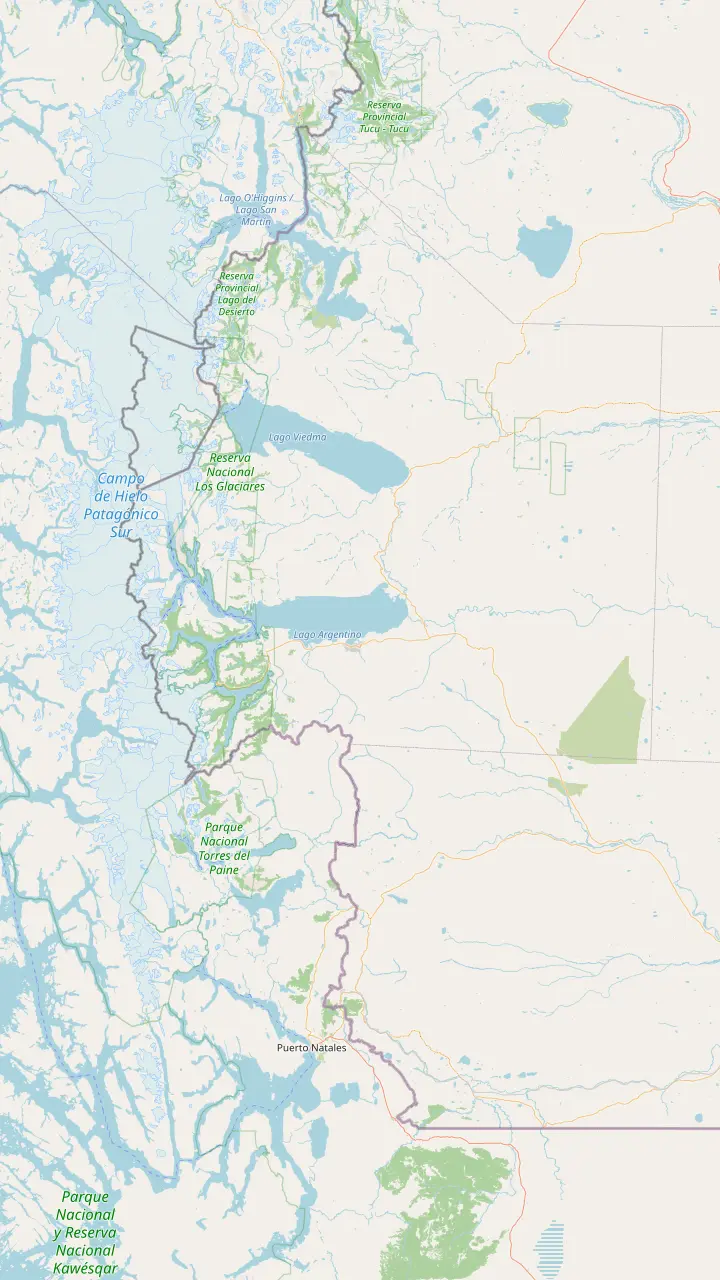
First pick a route, then tap any pin or stop for details and Google Maps.
Founded in 1985 on land the national park gave up, and now the base for its north zone.
Google Maps37 km north of El Chaltén; the lake runs 12 km, and a 1-hour walk leads to the Huemul glacier.
Google MapsAcross the border on Lake O'Higgins: the walk from Lago del Desierto takes about 6 hours, open November to March.
Google MapsComing from the north, drive 35 km past Tres Lagos on Route 40, then 90 km on Route 41.
Google MapsEl Calafate is the base for the park's south zone, and buses leave here for El Chaltén every day.
Google Maps80 km from El Calafate on Route 11; from September to April the access corridor opens 8 to 18 h.
Google MapsThe Puerto Natales park buses run by way of Laguna Amarga, Pudeto and the park administration.
Google MapsChile lists it open to every kind of vehicle, with Puerto Natales the nearest town; Torres del Paine's Sarmiento gate is 52 km away.
Google MapsChile lists it open to every kind of vehicle, at 605 m, with Puerto Natales the nearest town.
Google MapsTorres del Paine buses leave at 7:30 and 14:30, and Route Y-290 reaches the park in 80 km.
Google Maps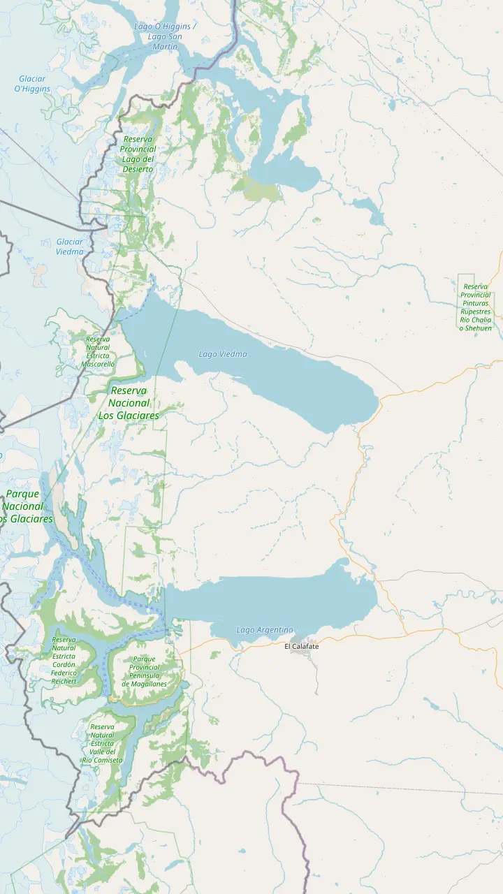
El Calafate is the base for the park's south zone, and buses leave here for El Chaltén every day.
Google MapsComandante Armando Tola airport, 22 km from El Calafate and 200 km from El Chaltén on paved road.
Google MapsThe roadside inn where the El Chaltén day tour takes its 30-minute break.
Google MapsViedma Glacier boats sail from this pier: 10 km on Route 23, then 8 km on the bay road from El Chaltén.
Google MapsFounded in 1985 on land the national park gave up, and now the base for its north zone.
Google Maps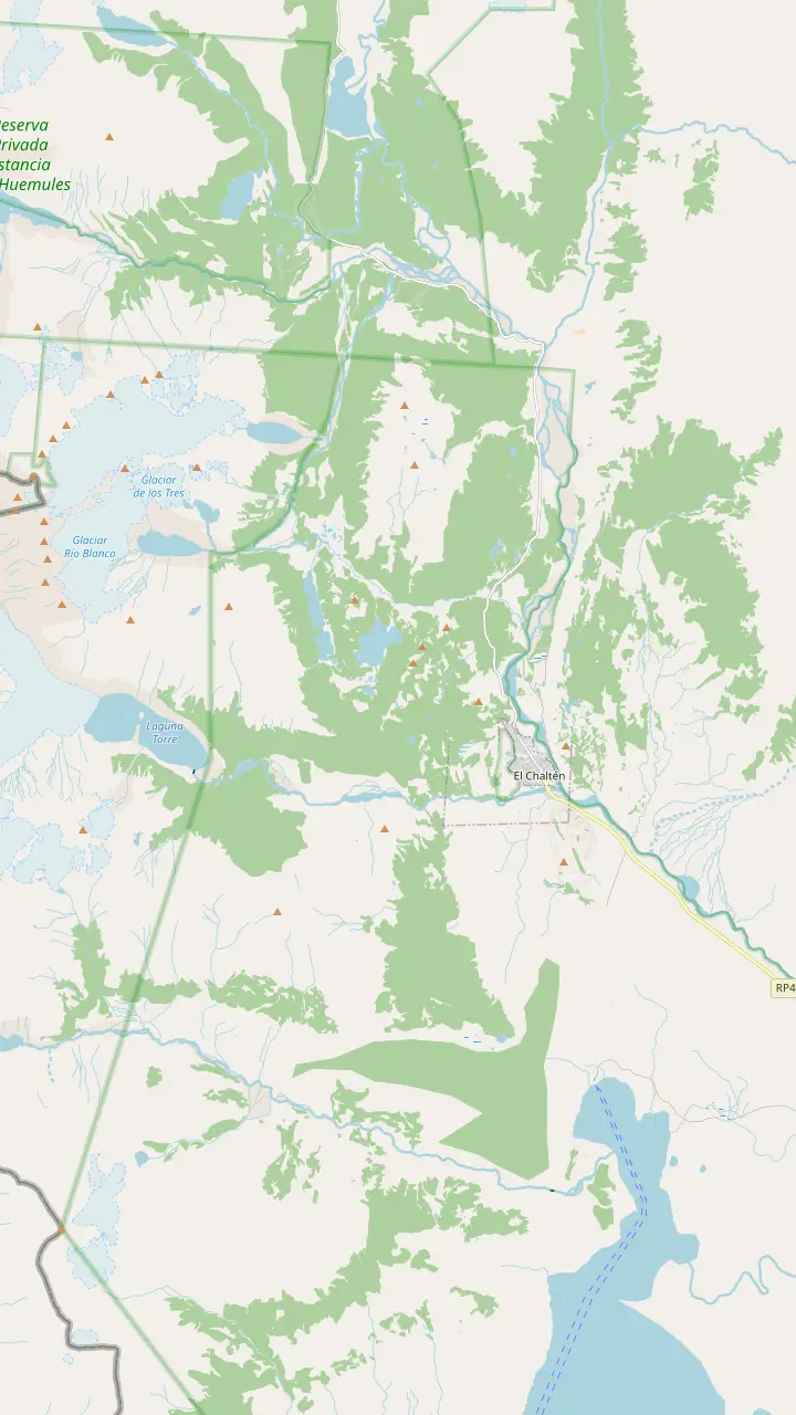
The park's visitor center sits just before the first houses; climbers and remote-area hikers register here or online, and the Los Cóndores path leaves from its door.
Google MapsThe park leaflet puts it 45 minutes and 1 km up from the trailhead, looking down on the village; condors and black-chested eagles often ride the wind here.
Google MapsA branch beyond Los Cóndores, about 1 hour and 2 km on the park leaflet, facing the steppe and Lake Viedma.
Google MapsA 20 m waterfall in lenga forest: 40 minutes on foot by the leaflet, or drive Route 41 to the car park and walk 10 minutes.
Google MapsAn open bend of the Fitz Roy trail, 1 hr 30 min and 4 km out on the park leaflet.
Google MapsThe first lake on the Fitz Roy trail, 1 hr 45 min one way on the leaflet; its campsite needs a booking.
Google MapsThe closest trail viewpoint to Fitz Roy: 5 hours one way and 750 m of climb on the leaflet, steep at the end.
Google MapsA ridge view up the Fitz Roy river valley, 1 hr 15 min along the Laguna Torre trail.
Google MapsThe glacier lake below Cerro Torre (3102 m), 3 hrs 30 min one way on the park leaflet.
Google MapsA 360-degree summit view of Lake Viedma, Cerro Torre and Fitz Roy: 4 hours up and 1000 m of climb.
Google Maps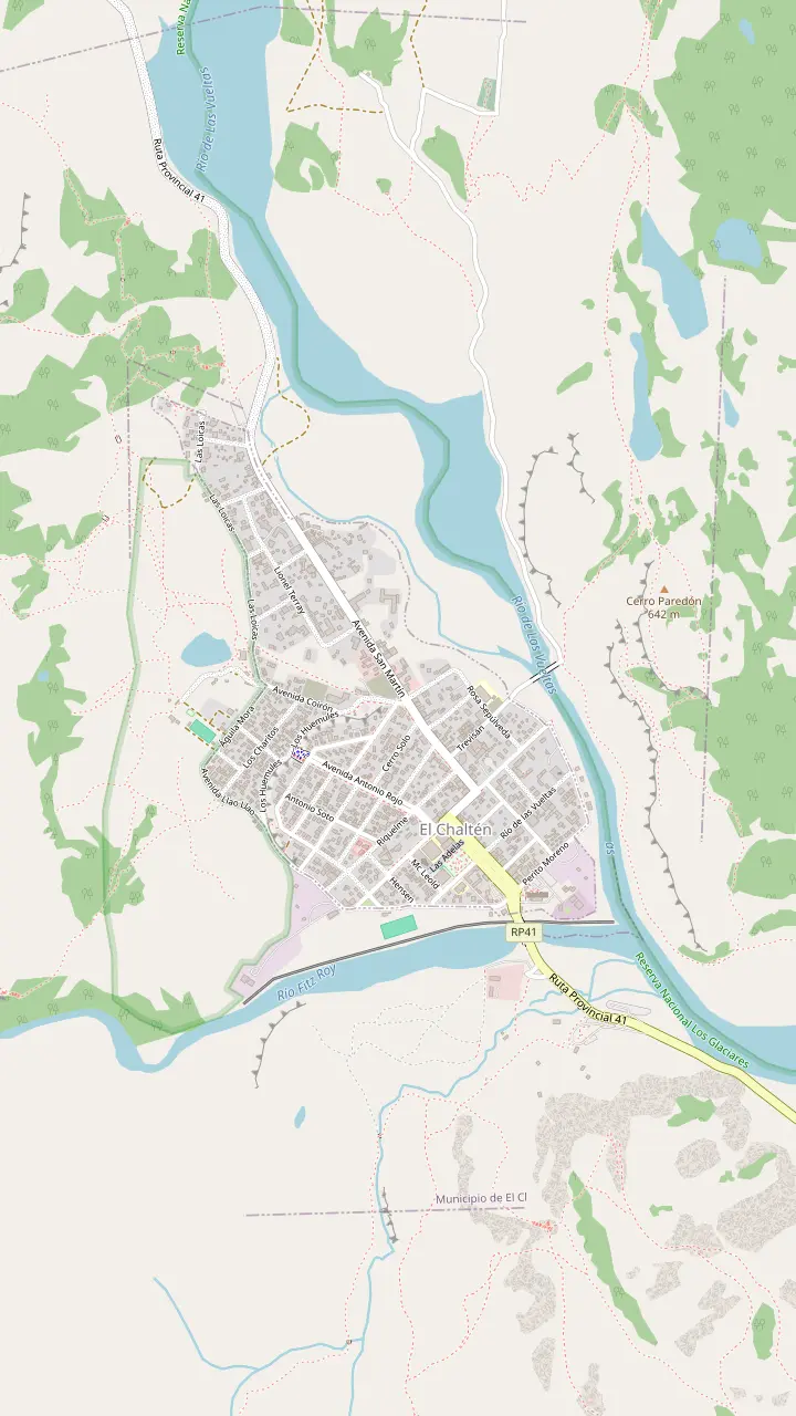
Buses from El Calafate pull in here, and the town's tourist information desk works inside the terminal.
Google MapsThe park's visitor center sits just before the first houses; climbers and remote-area hikers register here or online, and the Los Cóndores path leaves from its door.
Google MapsWhere the trail to Laguna Capri and on to Fitz Roy begins.
Google MapsStart of the path up the valley to Laguna Torre, 11 km away by the tourism office's count.
Google MapsBase map © OpenStreetMap contributors
Going from El Chalten to Perito Moreno means passing through El Calafate first. From there the roads run on to Puerto Natales and Torres del Paine, while Route 40 and a lake trail lead north.
Editorial team, elchaltendaytrip.top · Updated November 9, 2026 · Quick read: 9 min
Quick look
El Chaltén sits near the end of its own road, so almost every onward journey starts by going back the way you came, at least for a while. Route 41 covers 90 km between the village and Route 40 by the tourism office's count, 95 km by the national park's, and Route 40 is the main artery serving the park from either direction.8,9,10 Where you go from that junction decides the rest of your trip. Whichever way you turn, the first hour is the same view of the steppe and Lake Viedma, a fine farewell to the mountains.
Most people head south, for the glacier, the airport or Chile. The trip from El Chalten to Perito Moreno passes El Calafate, the hub for the southern half of the park, and from there routes continue across the border to Puerto Natales and Torres del Paine.11 A smaller number turn north on the same trunk road toward the lakes of central Patagonia and, much further on, Bariloche.6 Each direction has its own season, so the month of your trip narrows the choice before anything else does.
The third way is the most adventurous: a summer crossing on foot or by bike from Lago del Desierto into Chile, then a boat across Lake O'Higgins. Each of these routes is laid out below, with the official distances and seasons we could confirm, and the onward panel of the map shows the main points. Open it on your phone before you leave the village, while you still have a good signal. Where an official source gives no figure, we say so rather than guess.
Routes compared
| Destination | How | Key figure |
|---|---|---|
| Perito Moreno Glacier | Bus to El Calafate, then a tour | 80 km past El Calafate |
| El Calafate | Daily buses | 220 km |
| Puerto Natales | Bus via El Calafate | Don Guillermo or Dorotea |
| Torres del Paine | Bus from Puerto Natales | Departures 7:30 and 14:30 |
| Bariloche | Route 40 bus | 1,392 km |
| Villa O'Higgins, Chile | On foot and by boat | November to March |
From the national park, the El Chaltén tourism office, CONAF and Chile's border service.2,1,4,14,6,7
There is no direct road from the village to the glacier, and no shortcut across the lakes, so the journey always runs through El Calafate. You first travel to El Calafate, 220 km on the park's access page and 200 km on its activities page, all of it paved, and then take Route 11 for the last 80 km to the glacier.1,15,2 Scheduled buses make the run every day, so the sensible plan is a travel day south followed by a glacier day.12
From El Calafate, guided glacier days are the simplest way to the walkways. A glacier day with 2,735 reviews picks you up in town, drives about 1.5 hours each way and gives 3 hours at the glacier, with an optional boat, for a day of about 8 hours. It starts from $69, and it is the tour we suggest on this page. Self-drivers can follow the same road and buy the park ticket at the gate by card or in pesos, or online beforehand.16
The access corridor to the glacier keeps set hours. During the long season, 1 September to 30 April, entry is possible from 8 to 18 h and you may remain until 20 h; from 1 May to 31 August the window is 9 to 16 h, with visitors out by 18 h.17,18 Fitting the bus from El Chaltén and the glacier into a single day is therefore unrealistic; give it a night in El Calafate in between.
Chile's Torres del Paine National Park lies in the Magallanes region, in the province of Última Esperanza.23 It is a different country with its own currency, park rules and border checks, so plan this leg as carefully as a flight. The park authority, CONAF, points visitors to its own pages and to the Pases Parques ticket site as the only official sources of information.24 From Puerto Natales, Route Y-290, known as the Lago Porteño road, runs 80 km into the park.13 Plan your park ticket and transport before you cross, since the Chilean park sets its own rules and prices.
Buses link Argentina and Chile. The national park on the Argentine side notes that both the El Calafate and El Chaltén terminals receive services from southern Chile, naming Punta Arenas and Puerto Natales.3 If you need a bus from Puerto Natales to El Chalten, check at the terminal which company runs the route on your date, since services and days change with the season. One bookable coach between Puerto Natales and El Calafate is listed at 5 hours, from $64.
Once in Puerto Natales, regular buses run on into Torres del Paine. CONAF lists 4 companies leaving the town at 7:30 and 14:30, stopping at Laguna Amarga, Pudeto and the park administration.14 Anyone planning the whole trip into the Chilean park in one go should expect to change in El Calafate or Puerto Natales, and to spend a night along the way. Trying to do it all in one day leaves you arriving at the park after the buses have gone.
Where next?
Your next stop and your time decide the way.
If I want the glacier next
Bus to El Calafate, tour next day
Route 11 covers the last 80 km from town.2
If I am heading to Torres del Paine
Via Puerto Natales
Park buses leave at 7:30 and 14:30.14
If I am driving a rental car
Río Don Guillermo crossing
52 km from the park's Sarmiento gate.20
If I am going north by bus
Route 40 to Bariloche
Several services a week, October to April.6
If I want an adventure into Chile
Walk from Lago del Desierto
Ways out
South
Via El Calafate
Chile
From El Calafate
North
North of the village
Drivers have a choice of crossings toward Puerto Natales. Chile's border service lists Río Don Guillermo, at 260 m above sea level, and Dorotea, at 605 m, both open to every type of vehicle and both with Puerto Natales as the nearest town.4,5 CONAF names Río Don Guillermo, at Villa Cerro Castillo, as an important access to Torres del Paine, 52 km from the park's Sarmiento gate.20
Fuel planning matters on this side. CONAF warns that there are no fuel stations in Torres del Paine or around it, so fill up in Puerto Natales or before the border.52 The El Chaltén tourism office also advises carrying a can of extra fuel and checking the spare tire before a long drive in the region.53 El Chaltén itself has a fuel station, so leave the village with a full tank.55 Top up again in El Calafate if you are driving on toward the border.
If your car is rented in Argentina, confirm with the rental company in writing that you may take it into Chile, and carry the papers they give you for the border. Allow time for the formalities at both posts, especially in the high season when tour coaches cross too. Drive the gravel and the open steppe slowly: wind gusts and loose stones are the usual hazards, and help can be far away. Keep the headlights on and the seatbelts fastened, as the tourism office asks every driver to do.56
Price the next leg
Choose a tour or the bus and set how many of you travel.
Compare 4 choices
Choose a tour or the bus and set how many of you travel.
≈
View≈
View≈
View≈
ViewStarting prices from GetYourGuide, converted at the ECB reference rate. You will see the exact price when booking.
A classic loop
Route 40 is the trunk road of this part of Argentina, and Santa Cruz province holds its kilometre 0.10,57 Heading north from El Chaltén, you return to Route 40 and pass Tres Lagos; the tourism office gives the junction as 35 km from Tres Lagos on Route 40 and then 90 km of Route 41 to the village, where the park counts 95 km.8,9 Beyond that the road crosses some of the emptiest country in Patagonia, with long gaps between villages and fuel stops.
For long-distance travelers, the tourism office lists bus services from Bariloche to El Chaltén along Route 40, a journey of 1,392 km, with several departures a week from October to April.6 The same road carries traffic in the other direction, so north-bound riders should ask at the El Chaltén terminal which days the service runs during their stay. Outside those months, plan on flying north from El Calafate instead.
Travelers searching for a bus from El Chalten to El Bolson should do the same: ask the companies at the terminal whether a north-bound service stops there, and on which days. We found no official timetable to quote, so we will not invent one. Whatever the route, carry food and water on these long legs, because services along the road are spread thin. Download offline maps before you leave the village, since phone signal fades fast on the steppe.
Video
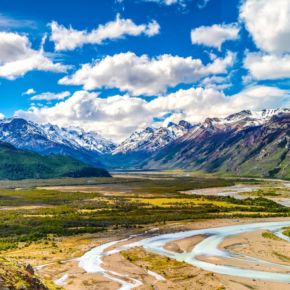
Samuel and Audrey - Travel and Food Videos on YouTube · Tap play to load the video; not before.
There is a ship crossing the lake once a week, allowing to get to Villa O’Higgins where the Carretera Austral begins
Before you leave
The most memorable way out of El Chaltén is a walk, and it starts with a ride up the valley. Lago del Desierto lies 37 km north of the village along the Río de las Vueltas valley, reached by a gravel road.19,58 From the north shore, by the Argentine border police post, a path for walkers and cyclists leads past small lakes to the Chilean border at boundary marker IV, open from November to March.7
On the Chilean side, the tourism office explains, a Carabineros post asks for your passport or identity card for the customs formalities, and the hike takes about 6 hours.21 At Lake O'Higgins you can camp or stay at Candelario Mancilla, where food is available, and a boat crosses the lake once a week to Villa O'Higgins, where the Carretera Austral begins.22 Missing that boat can mean a long wait, so build in spare days.
This is a real expedition rather than a day out, and it depends on the weather at every stage, from the lake crossings to the open stretches of trail. Check the boat schedules on both lakes before you set off, carry enough food for delays, and expect wet feet and wind. It is a beautiful route for well-prepared hikers and cyclists heading north into Chile, and a good reason to end an El Chaltén stay on foot rather than on a coach.
The classic loop runs El Calafate, El Chaltén, El Calafate, Puerto Natales. Arrive by air, visit the ice, head north to hike, come back south and finish across the border at Torres del Paine. Every leg uses daily or regular buses, and the loop needs no car, though the El Chalten to Torres del Paine bus journey always involves a change.12,3 Reserve every coach leg early once the plan is set, because summer departures can sell out. Keep the bus tickets on paper as well as on your phone for the border.
If time is short, El Calafate also sells Torres del Paine as a day trip. One listing runs 16 hours, with about 7 hours on the road out and 8 back, from $207. Another stops at Cancha Carrera, Cerro Castillo, the Grey Glacier and the park itself. They are long days, but they save a night of moving bags if Chile is a side trip rather than a destination. Bring your passport even on a day tour, because the coach crosses the border twice.
In winter, leave margins. Snowstorms can cut the roads around El Chaltén, and the tourism office advises building slack into any arrival or departure.54 Make sure you hold a return or onward ticket before you arrive, as the tourism office also advises.51 A spare day at the end of the trip costs little and protects a flight. Use it for a lake cruise or a last walk if the road stays open.
FAQ
The El Chaltén terminal receives services from southern Chile, including Puerto Natales.3
The crossing from Lago del Desierto at boundary marker IV is open November to March.7
Several weekly services cover the 1,392 km along Route 40.6
Sources
Read next
Tour, bus or car to El Chalten? Ask a real person.