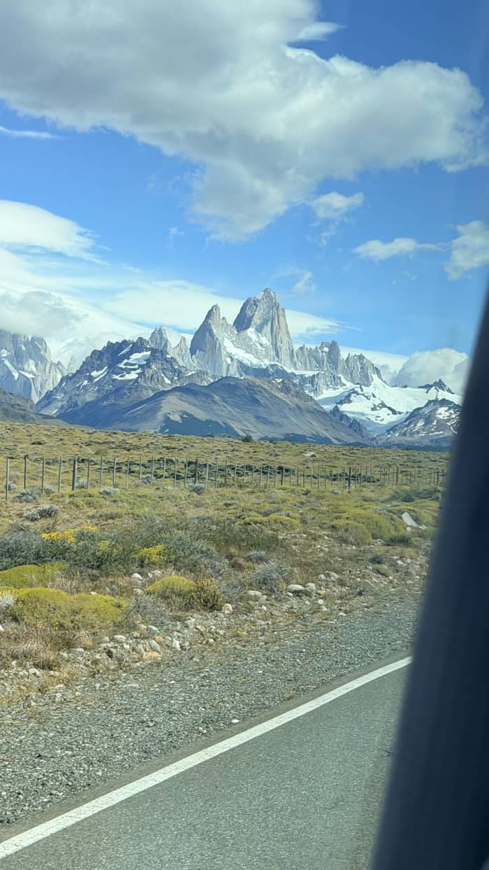
Short
Los Cóndores
Viewpoint over the village
- One way45 min
- Climb100 m
- Starts atVisitor center
Guides
Language
Currency
Look up datesfrom $117 · free to cancelYour stop on the map
Full day from El Calafate to El Chalten
★ 4.4 · 1,003 reviews total
Short answer
The best things to do in El Chalten are its day hikes, from the short Los Cóndores viewpoint to Laguna Capri, Laguna Torre and the long climb to Laguna de los Tres under Fitz Roy.
Trail rules
See 26 route stops
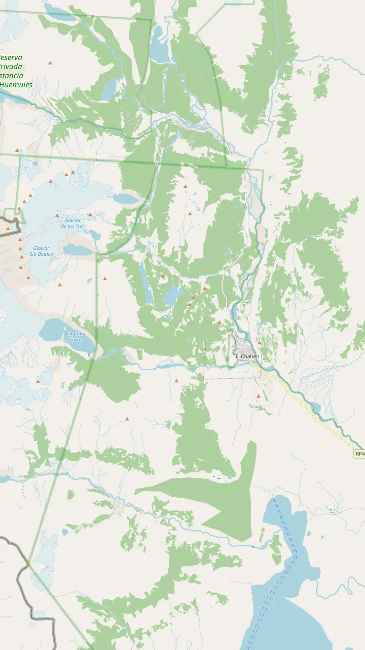
First pick a route, then tap any pin or stop for details and Google Maps.
The park's visitor center sits just before the first houses; climbers and remote-area hikers register here or online, and the Los Cóndores path leaves from its door.
Google MapsThe park leaflet puts it 45 minutes and 1 km up from the trailhead, looking down on the village; condors and black-chested eagles often ride the wind here.
Google MapsA branch beyond Los Cóndores, about 1 hour and 2 km on the park leaflet, facing the steppe and Lake Viedma.
Google MapsA 20 m waterfall in lenga forest: 40 minutes on foot by the leaflet, or drive Route 41 to the car park and walk 10 minutes.
Google MapsAn open bend of the Fitz Roy trail, 1 hr 30 min and 4 km out on the park leaflet.
Google MapsThe first lake on the Fitz Roy trail, 1 hr 45 min one way on the leaflet; its campsite needs a booking.
Google MapsThe closest trail viewpoint to Fitz Roy: 5 hours one way and 750 m of climb on the leaflet, steep at the end.
Google MapsA ridge view up the Fitz Roy river valley, 1 hr 15 min along the Laguna Torre trail.
Google MapsThe glacier lake below Cerro Torre (3102 m), 3 hrs 30 min one way on the park leaflet.
Google MapsA 360-degree summit view of Lake Viedma, Cerro Torre and Fitz Roy: 4 hours up and 1000 m of climb.
Google Maps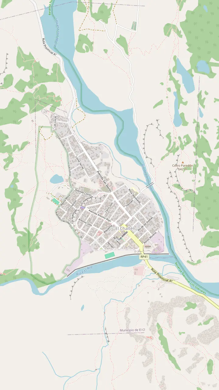
Buses from El Calafate pull in here, and the town's tourist information desk works inside the terminal.
Google MapsThe park's visitor center sits just before the first houses; climbers and remote-area hikers register here or online, and the Los Cóndores path leaves from its door.
Google MapsWhere the trail to Laguna Capri and on to Fitz Roy begins.
Google MapsStart of the path up the valley to Laguna Torre, 11 km away by the tourism office's count.
Google Maps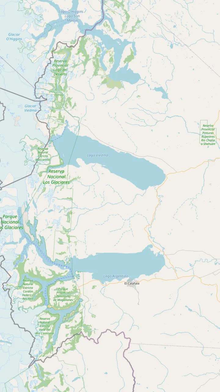
El Calafate is the base for the park's south zone, and buses leave here for El Chaltén every day.
Google MapsComandante Armando Tola airport, 22 km from El Calafate and 200 km from El Chaltén on paved road.
Google MapsThe roadside inn where the El Chaltén day tour takes its 30-minute break.
Google MapsViedma Glacier boats sail from this pier: 10 km on Route 23, then 8 km on the bay road from El Chaltén.
Google MapsFounded in 1985 on land the national park gave up, and now the base for its north zone.
Google Maps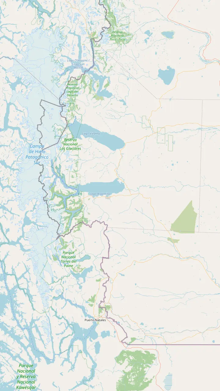
Founded in 1985 on land the national park gave up, and now the base for its north zone.
Google Maps37 km north of El Chaltén; the lake runs 12 km, and a 1-hour walk leads to the Huemul glacier.
Google MapsAcross the border on Lake O'Higgins: the walk from Lago del Desierto takes about 6 hours, open November to March.
Google MapsComing from the north, drive 35 km past Tres Lagos on Route 40, then 90 km on Route 41.
Google MapsEl Calafate is the base for the park's south zone, and buses leave here for El Chaltén every day.
Google Maps80 km from El Calafate on Route 11; from September to April the access corridor opens 8 to 18 h.
Google MapsThe Puerto Natales park buses run by way of Laguna Amarga, Pudeto and the park administration.
Google MapsChile lists it open to every kind of vehicle, with Puerto Natales the nearest town; Torres del Paine's Sarmiento gate is 52 km away.
Google MapsChile lists it open to every kind of vehicle, at 605 m, with Puerto Natales the nearest town.
Google MapsTorres del Paine buses leave at 7:30 and 14:30, and Route Y-290 reaches the park in 80 km.
Google MapsBase map © OpenStreetMap contributors
The best things to do in El Chalten start at the edge of the village: short viewpoints, the lakes under Fitz Roy and Cerro Torre, and longer days for strong legs, each with the park's own times.
Editorial team, elchaltendaytrip.top · Updated November 9, 2026 · Quick read: 9 min
Quick look
Most El Chalten things to do happen on foot. The village was declared the National Trekking Capital in 1994, and the trails that leave its northern and western edges are the reason people come.6 The park grades them low, medium or high in difficulty and asks every walker to be honest about their own limits.7 That spread is what makes the place work for families, casual walkers and serious hikers in the same week.
The national park publishes a trail leaflet with a time, a climb and a distance for each route, and the town's tourism office describes the same walks on its own pages. These sources sometimes disagree by an hour or a few kilometers, so this guide gives both where they differ and names the source each time. Treat every figure as a guide for planning, not a promise: wind, snow and your own pace move them more than any table can.
Beyond the trails, El Chalten activities include boat trips to glaciers, rafting and kayaking on the Río de las Vueltas, rock climbing and bike rides out of the village. Further down this page, a map marks the main trailheads and viewpoints; open its hikes panel and tap a pin for its note. If you are only here for an afternoon on a day tour, start with the short walks in the next section and save the lakes for a return visit. The longer walks for a stay of several days follow after them, from Laguna Capri to Laguna de los Tres.
Trail by trail
| Trail | One way (park leaflet) | Climb | Distance |
|---|---|---|---|
| Los Cóndores viewpoint | 45 min | 100 m | 1 km |
| Las Águilas viewpoint | 1 hr | 100 m | 2 km |
| Chorrillo del Salto | 40 min | Not listed | 3 km |
| Torre viewpoint | 1 hr 15 min | 250 m | 3 km |
| Laguna Capri | 1 hr 45 min | 350 m | Not listed |
| Laguna Torre | 3 hrs 30 min | 250 m | 10 km |
| Loma del Pliegue Tumbado | 4 hrs | 1000 m | 10 km |
| Laguna de los Tres | 5 hrs | 750 m | 10 km |
One-way times, climbs and distances from the national park's north zone trail leaflet; the tourism office's times can differ.1,15,16,20,9,21,22,11
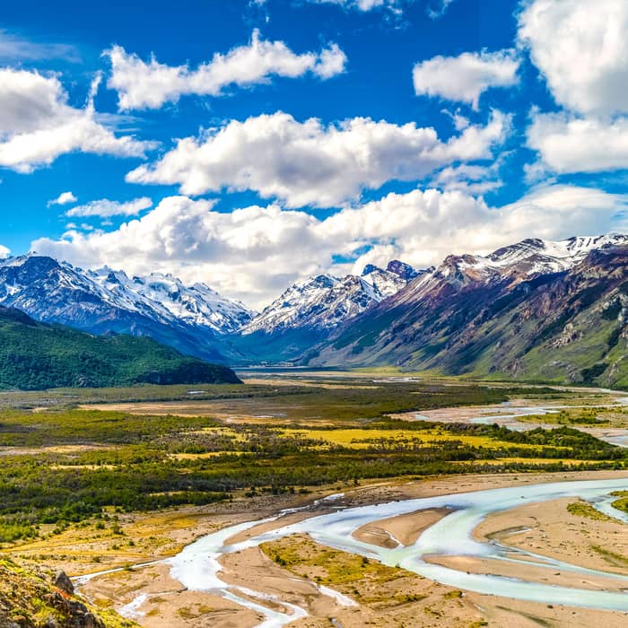
The Los Cóndores viewpoint is the gentlest climb with a big reward. The park leaflet gives 45 minutes, about 100 m of ascent and 1 km from the trailhead, while the tourism office allows 1 hour 30 minutes each way and 3 hours in all.1,13 Either way you finish above the rooftops, with the river valley and the granite spires in one frame. The path starts at the park visitor center at the entrance to the village.14
From the same path a branch continues to Las Águilas, about 1 hour and 2 km on the leaflet, where the view turns east over the steppe and part of Lake Viedma.15 Pair these viewpoints and you have a gentle morning with the village always in sight. Bring a windproof layer: these are exposed shoulders of open ground, and the gusts that make the condors look effortless can knock a careless walker off balance.
Chorrillo del Salto, the waterfall north of town, is the easiest trail in the area by the leaflet's own description, about 40 minutes and 3 km on foot.16 The tourism office puts it 4 km out, reachable on foot in an hour or in a 10-minute drive along Route 41.17,18 The park's activities page gives 6 km from the village for the outing as a whole, so allow half a day if you walk the road both ways.19
Of the best El Chalten day hikes, the Fitz Roy trail leaves from the top of the village, and the park recommends its first stretch, as far as Laguna Capri, to anyone with only one day.2 On the park leaflet the first open view of the range comes after about 1 hour 30 minutes and 4 km, and Laguna Capri after 1 hour 45 minutes with 350 m of climbing.8,9 The tourism office puts a round trip to Capri at 3 hours 30 minutes, which makes it a good full-view hike for a short stay.27
Beyond Capri the path levels through forest to the Poincenot campsite, 2 hours 45 minutes out on the leaflet.10 Then comes the climb to Laguna de los Tres, which the leaflet lists at 5 hours one way, 750 m of ascent and 10 km, warning that the trail is very steep and dangerous in wind and rain.11 The tourism office calls the lake the closest point to Fitz Roy you can reach on a trekking trail.12
The park's web page counts the whole outing at 8 to 9 hours and 25 km, graded medium to high.3 That is a full day for a fit walker who starts early, which is why the standard coach day from El Calafate leaves it out; a guided trek from El Calafate that does include it runs 16 hours. Heed the leaflet's warning about the steep final section in wind and rain, and remember that the park asks you to be back in town before dark.11,28
Which trail?
Time, legs and weather point to one trail.
If I have an afternoon
Los Cóndores and Las Águilas
Short climbs that start at the visitor center.14
If I have one full day and want Fitz Roy
Laguna Capri
The park calls it ideal for anyone with a single day.2
If I want Cerro Torre without a big climb
Laguna Torre
The tourism office says it needs no extreme effort.24
If I am fit and the forecast is clear
Laguna de los Tres
The park counts 25 km over 8 to 9 hours.3
If I want the widest view
Loma del Pliegue Tumbado
A 360-degree view of Lake Viedma, Torre and Fitz Roy.25
If The weather is wild
Lago del Desierto or rafting
Low-level outings away from the high trails.26
The classics
Short
Viewpoint over the village
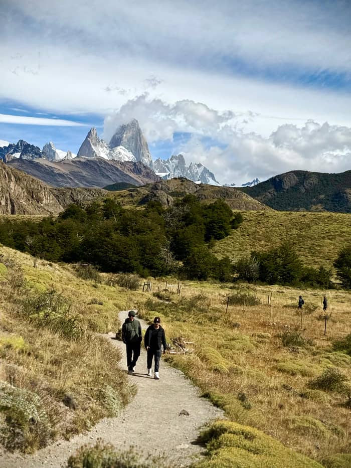
Medium
Glacier lake under Cerro Torre
Long
The lake under Fitz Roy
The second classic leaves from the western side of the village and follows the Fitz Roy River up its valley toward Cerro Torre.35 The park's web page gives 3 to 4 hours each way and 18 km for the round trip, and the leaflet lists 3 hours 30 minutes and 10 km to the lake with 250 m of climbing.4,21 The tourism office measures 11 km from town, and describes the walk as one of the best views in the park without extreme physical demand.35,24
If you have less time, the Torre viewpoint makes a good turnaround: the leaflet puts it at 1 hour 15 minutes and 3 km, and recommends it for anyone visiting for just a day.20 The tourism office gives the same time but measures 5 km, so treat both distances as estimates.59 From the viewpoint you see the valley, the Grande Glacier and, with luck, the needle of the Torre itself.
At the lake, the Grande Glacier drops into the water below Cerro Torre, which the tourism office gives as 3102 m high.33 Hardy walkers continue along the moraine to the Maestri viewpoint, 4 hours 30 minutes and 12 km out on the leaflet, a stretch it describes as exposed to wind.60 The De Agostini campsite near the lake needs a booking with the association that runs it, like the Capri and Poincenot camps.61
Hike with a guide
Pick a guided day from El Calafate and set your group size.
Compare 4 choices
Pick a guided day from El Calafate and set your group size.
≈
View≈
View≈
View≈
ViewStarting prices from GetYourGuide, converted at the ECB reference rate. You will see the exact price when booking.
Up the Fitz Roy trail
Trailhead
The path toward Fitz Roy and Laguna Capri starts here.2
1 hr 30 min
The first open view of the range, 4 km out.8
1 hr 45 min
Lake, campsite and the massif across the water.9
2 hrs 45 min
A campsite inside the forest.10
5 hrs
Loma del Pliegue Tumbado is the big viewpoint day. The tourism office describes a 360-degree panorama of Lake Viedma, Cerro Torre and Fitz Roy from the top.25 The leaflet gives 4 hours one way, 1000 m of ascent and 10 km, the biggest climb of any trail in the table on this page.22 Near the top the marked path gives way to yellow stakes, so follow them closely in cloud.62 Start early and check the forecast, because the weather in town differs from the weather in the mountains.63
Laguna Toro, further along the same valley, is a different kind of outing. The leaflet lists 7 hours one way and 16 km, warns that the trail is unmarked and requires you to register before you go.23 The tourism office repeats that registering at the park office in town is obligatory for this circuit.64 Treat it as an overnight trip for experienced hikers, not a long day walk. Ask at the visitor center about river crossings and snow before you commit, and leave your plan with someone in town.
The Madre e Hija trail joins the Fitz Roy and Torre valleys, so strong walkers can go out on the Fitz Roy trail and come back by Laguna Torre. The forks sit 7 km out on the Fitz Roy side and 5.5 km out on the Torre side, according to the leaflet, which lists the link itself at 2 hours 30 minutes.65,66 Plan it only with a clear forecast and plenty of daylight, because it turns a long day into a very long one.
Video
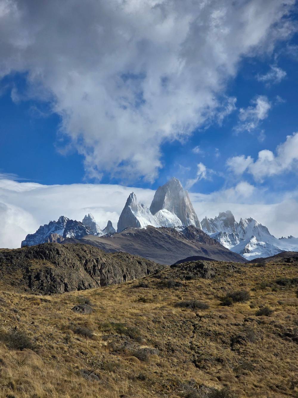
World Wild Hearts on YouTube · Tap play to load the video; not before.
Crossing the river at this point begins the last hour climb to reach “de los Tres” Laguna and Glacier, which is the closest point to observe the Cerro Fitz Roy from the trekking trails
Trail kit
Day trips from El Chalten reach well past the park boundary. Lago del Desierto lies 37 km north along Route 41 and the Río de las Vueltas valley, a lake 12 km long hemmed in by forest.26,50 From its southern shore a short hike of about 1 hour reaches the front of the Huemul glacier, for which an entrance fee is charged.51 Agencies in town arrange the trip, and it makes a calm alternative when the high peaks are lost in cloud. Pack a picnic, since the far shore is wild country with few services.
Piedra del Fraile sits 15 km north, where a 2-hour path from the Río Eléctrico bridge crosses private land to a refuge that charges for access.67 The area has a private campsite and looks toward the Marconi glacier and the northern face of Fitz Roy.68 To the south, boats leave Bahía Túnel for the Viedma Glacier, which the tourism office calls the largest in Argentina.69 One listed boat trip lasts 4 hours, with 2 hours of sailing at the ice.
On the water closer to town, a rafting trip on the Río de las Vueltas lasts 3 hours and starts in the village, from $120. A kayak outing on the same river runs 5 hours with the transfers. Bikes can be rented in town, and local agencies run rock climbing days that the tourism office says can include children over 8.70,71 None of these needs mountain fitness, which makes them good weather-day alternatives.
The north zone of the park now charges an access fee, and its trails start from the village.72 At the portals the park names as Los Cóndores, Cerro Torre Base Fitz Roy and Río Eléctrico, you buy tickets online only, either on the website or through the QR code posted there, and you need a card to pay.5 Rates set from June 1, 2026 put the general fee at ARS 50,000, and children up to 6 enter free.73,74 Buy the ticket while you still have signal in the village, since coverage on the trails is patchy.
There are no shops on the trails, so carry water, food, a warm spare layer, sunglasses, a torch and sunscreen.55 The park asks you to walk only on authorised paths, never alone if you can help it, and never to light a fire in this zone.57,56,58 Between May and September, poles and crampons are compulsory because ice, snow and mud cover the paths.75 Walking or skating on a frozen lagoon is forbidden in any month.76
Wildlife needs the same respect. The leaflet asks you to keep your distance from a huemul, avoid sudden movements and tell a ranger, and it advises not running from a puma or turning your back on it.77,78 The tourism office adds that this is puma country, so children should stay at your side on quieter trails.79 Feeding any animal is forbidden, and the ranger's word is final on the trail.80,81
FAQ
The park gives 18 km round trip through the Fitz Roy river valley.4
North zone tickets are sold online only and paid by card; cash is not accepted.5
Registration is compulsory for climbing and remote trekking, and from May to September for the trails too.54
From May to September trails carry ice, mud and snow, and poles and crampons are compulsory.75
The park leaflet calls it the easiest trail in the area, about 40 minutes one way.16
De Agostini, Capri and Poincenot are run by an association and need a booking.61
Sources
Read next
Tour, bus or car to El Chalten? Ask a real person.