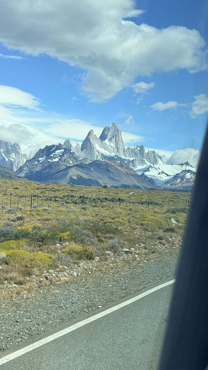
Self-drive
Your own hire car
Stop where you like
See this optionGuides
Language
Currency
Look up datesfrom $117 · free to cancelYour stop on the map
Short answer
The drive from El Calafate to El Chalten follows Route 11, Route 40 and paved Route 41 for about 220 km; carry spare fuel, keep headlights on and fit chains or studded tyres in winter.
Driving essentials
See 26 route stops
First pick a route, then tap any pin or stop for details and Google Maps.
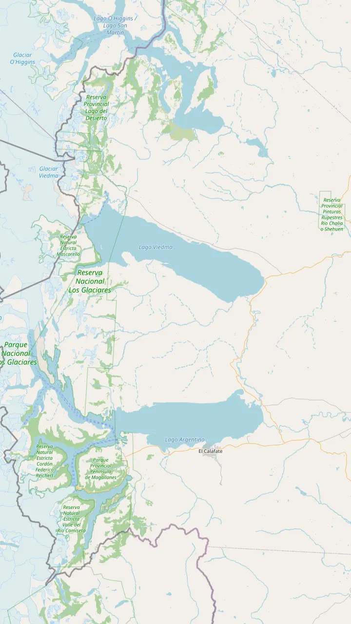
El Calafate is the base for the park's south zone, and buses leave here for El Chaltén every day.
Google MapsComandante Armando Tola airport, 22 km from El Calafate and 200 km from El Chaltén on paved road.
Google MapsThe roadside inn where the El Chaltén day tour takes its 30-minute break.
Google MapsViedma Glacier boats sail from this pier: 10 km on Route 23, then 8 km on the bay road from El Chaltén.
Google MapsFounded in 1985 on land the national park gave up, and now the base for its north zone.
Google Maps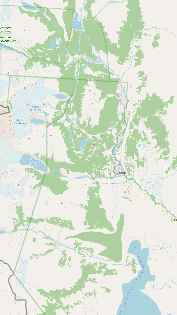
The park's visitor center sits just before the first houses; climbers and remote-area hikers register here or online, and the Los Cóndores path leaves from its door.
Google MapsThe park leaflet puts it 45 minutes and 1 km up from the trailhead, looking down on the village; condors and black-chested eagles often ride the wind here.
Google MapsA branch beyond Los Cóndores, about 1 hour and 2 km on the park leaflet, facing the steppe and Lake Viedma.
Google MapsA 20 m waterfall in lenga forest: 40 minutes on foot by the leaflet, or drive Route 41 to the car park and walk 10 minutes.
Google MapsAn open bend of the Fitz Roy trail, 1 hr 30 min and 4 km out on the park leaflet.
Google MapsThe first lake on the Fitz Roy trail, 1 hr 45 min one way on the leaflet; its campsite needs a booking.
Google MapsThe closest trail viewpoint to Fitz Roy: 5 hours one way and 750 m of climb on the leaflet, steep at the end.
Google MapsA ridge view up the Fitz Roy river valley, 1 hr 15 min along the Laguna Torre trail.
Google MapsThe glacier lake below Cerro Torre (3102 m), 3 hrs 30 min one way on the park leaflet.
Google MapsA 360-degree summit view of Lake Viedma, Cerro Torre and Fitz Roy: 4 hours up and 1000 m of climb.
Google Maps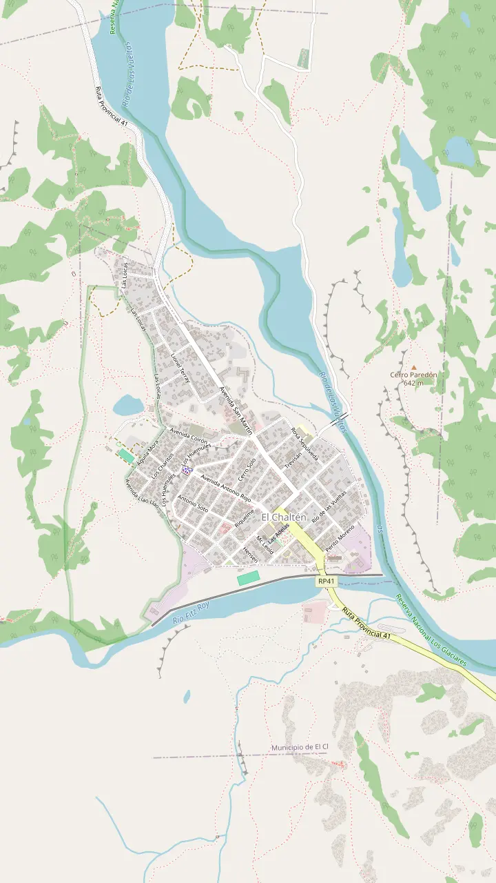
Buses from El Calafate pull in here, and the town's tourist information desk works inside the terminal.
Google MapsThe park's visitor center sits just before the first houses; climbers and remote-area hikers register here or online, and the Los Cóndores path leaves from its door.
Google MapsWhere the trail to Laguna Capri and on to Fitz Roy begins.
Google MapsStart of the path up the valley to Laguna Torre, 11 km away by the tourism office's count.
Google Maps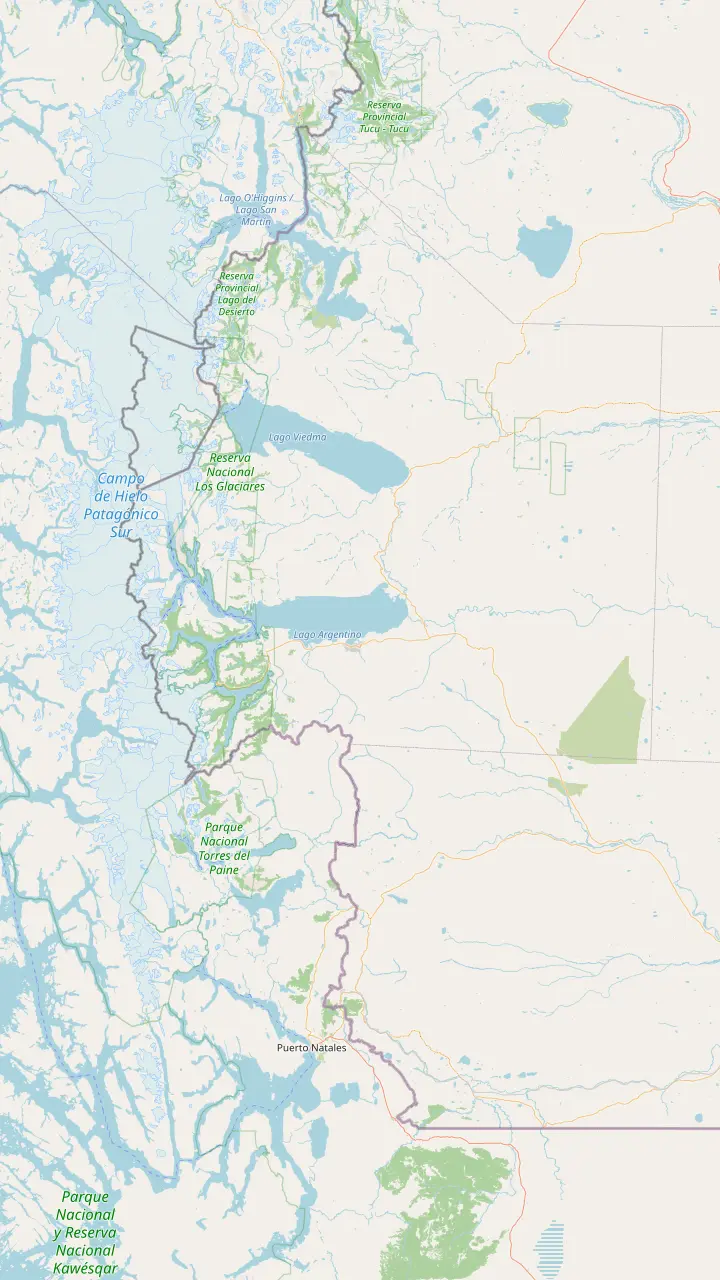
Founded in 1985 on land the national park gave up, and now the base for its north zone.
Google Maps37 km north of El Chaltén; the lake runs 12 km, and a 1-hour walk leads to the Huemul glacier.
Google MapsAcross the border on Lake O'Higgins: the walk from Lago del Desierto takes about 6 hours, open November to March.
Google MapsComing from the north, drive 35 km past Tres Lagos on Route 40, then 90 km on Route 41.
Google MapsEl Calafate is the base for the park's south zone, and buses leave here for El Chaltén every day.
Google Maps80 km from El Calafate on Route 11; from September to April the access corridor opens 8 to 18 h.
Google MapsThe Puerto Natales park buses run by way of Laguna Amarga, Pudeto and the park administration.
Google MapsChile lists it open to every kind of vehicle, with Puerto Natales the nearest town; Torres del Paine's Sarmiento gate is 52 km away.
Google MapsChile lists it open to every kind of vehicle, at 605 m, with Puerto Natales the nearest town.
Google MapsTorres del Paine buses leave at 7:30 and 14:30, and Route Y-290 reaches the park in 80 km.
Google MapsBase map © OpenStreetMap contributors
What to expect on the drive from El Calafate to El Chalten: the roads you follow, how far it really is, where to stop, the rules for winter and what car hire adds to the bill.
Editorial team, elchaltendaytrip.top · Updated November 9, 2026 · Quick read: 7 min
Quick look
The drive from El Calafate to El Chalten follows a short chain of roads, and none of them is hard to find. Leaving town you take Provincial Route 11 east for 44 km to its junction with National Route 40, which the park describes as the trunk road bringing travelers in from north and south.2,3 You then head north across the steppe on Route 40.3
The final leg turns west onto Provincial Route 41, once numbered Route 23 and still shown that way on older maps.7 The national park gives this branch as 95 km of paved road, while the town tourism office says 90 km.4,7 Either way, it runs along Lake Viedma with the mountains growing in front of you.8
There is nothing complicated about the navigation: once you turn onto Route 41, the road ends in the village.4 What deserves your attention is the surface on bends, the wind on the open stretches and the animals near the verge, not the map. Fill the tank in El Calafate and set off with daylight to spare.
Official figures
| From | Distance | Source |
|---|---|---|
| El Calafate | 220 km1 | National park, access page |
| El Calafate | 200 km12 | National park, activities page |
| El Calafate airport | 200 km13 | Town tourism office |
| Turn-off from the main road | 95 km4 | National park |
| Turn-off from the main road | 90 km7 | Town tourism office |
Official pages give the same road different lengths; plan on the larger figure.1,12
The distance from El Calafate to El Chalten depends a little on which official page you read. On the national park’s access page the figure is 220 km, every kilometre of it asphalt, and the town tourism office uses the same number for the bus route.1,11 Another page of the same park service gives 200 km between the bases of its South and North Zones.12
For planning, use the larger figure: an extra stretch of road is easier to absorb than a fuel light. From the airport, which lies outside El Calafate, the town tourism office gives 200 km to El Chalten on a fully paved road.13 The airport is 22 km from El Calafate itself.13
Time is the more useful measure on a road like this. A private car day sold from El Calafate lists 3 hours by car in each direction, while guided coaches list 2.5 hours for each leg. Self-drivers who stop for photographs should plan on the longer figure, and longer still in strong wind, when a gusty crosswind makes any sensible driver ease off the pedal on the open straights.
The classic break is Parador La Leona, a roadside inn on Route 40 where guided days pause for 30 minutes for coffee and photographs.3 Private excursions stop there too, if more briefly. It is the obvious place to stretch, use a toilet and warm up before the last part of the journey, and the old building with its signposts makes a good photograph in its own right.
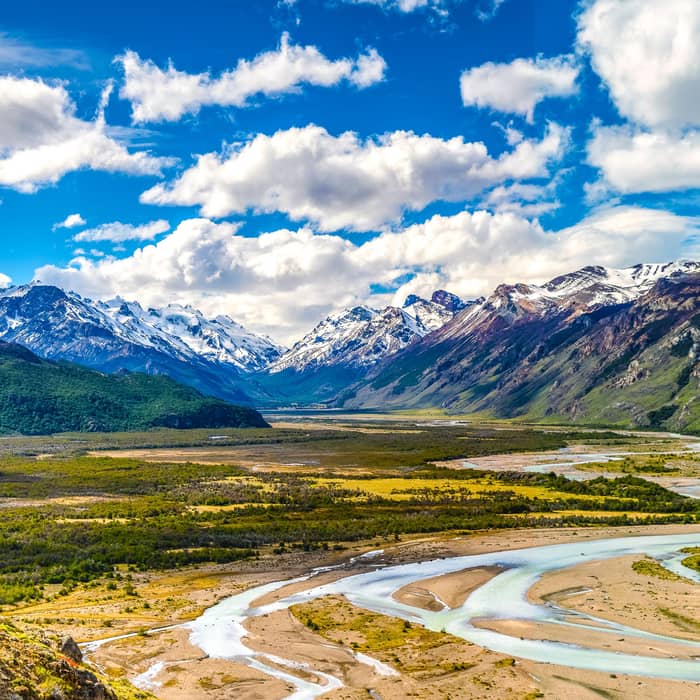
Once you turn west, the lake becomes the view. The town tourism office describes a paved road running along Lake Viedma on the way to the village, crossing the steppe toward the Andes.8 Pull off only where the verge is wide and firm; a car stopped on a bend is a hazard for everyone behind, and the gravel shoulder can be softer than it looks.
Close to the village, the Fitz Roy range takes over the horizon. Inside the park, the speed limit on park roads is 40 km/h, which also helps you spot wildlife in time.17 Drones are forbidden in the park, so leave yours in the boot however tempting the view.18 Pets are not allowed in the park either, which matters if you are touring Patagonia with a dog in the back seat.18
Drive or be driven
Match your trip to the right choice before you book a car.
If We are a family staying several nights
Hire a car
Costs spread across seats; the road is paved all the way.1
If I am alone and back the same evening
Take the guided day
Pickup and a guide in 11 hours, from $117.
If We want a car but no driving
Book a private car day
A driver for 15 hours, from $572.
If I am travelling in July
Think twice about driving
Chains or studded tyres are compulsory on park roads in snow or ice.15
If My licence is from abroad
Check the rules first
Carry your passport with the entry stamp and your licence.6
Who drives
Self-drive
Stop where you like
See this option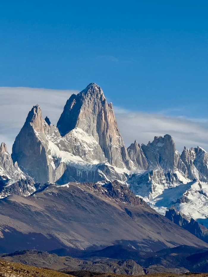
For groups
A driver, your pace
Booked here
Pickup and short walks
The road is paved and quiet, and most of the risk comes from the weather. The park warns that summer winds are strong, which on an open steppe road means firm hands on the wheel and extra care when a truck passes.59 Slow down before you open a door in a gust, and park facing into the wind where you can.
Winter is a different trip. Between May and October, the park says, cold and heavy snow set in, and it makes studded tyres or approved link chains compulsory on park roads when there is snow, frost or ice.60,15 The town tourism office adds that snowstorms can close the roads and that you should check conditions before setting out.5
Daylight is your best safety margin all year. The park asks visitors to plan outings so they are back before dark, and the same logic applies to the drive home.57 The park warns that coverage drops out in places, so leave your route with your lodging and do not count on calling for help from the roadside.61 Download an offline map before you leave El Calafate as well.
El Chalten does have a fuel station, listed by the town tourism office among the services in the village.9 Even so, the office advises carrying a can of extra fuel in case of trouble on the way, and checking that the spare tyre is in good order before you leave.16 On a long empty road, both are cheap insurance.
The town asks drivers to keep dipped headlights on at all times and seatbelts fastened.58 Dipped lights make you visible on a straight road where distances are hard to judge. Take sunglasses too: the low sun over the steppe and the glare off Lake Viedma can be hard on tired eyes.
Pack the car for the weather, not the forecast. The park suggests onion-style layers, since the wind bites and the nights stay chilly even in high summer.56 Keep water, food and a warm jacket inside the car rather than in the boot, so a long wait for help, or simply a stop for a view, stays comfortable even when the wind drops the temperature in minutes.
Video
or we could have had kids on YouTube · Tap play to load the video; not before.
Check that the spare tyre is in good condition and carry a can of extra fuel in case you have any trouble on the way.
Driver checklist
If you plan to rent a car from El Calafate to El Chalten, read the rental terms as closely as the map. Chalten Travel, which rents cars from El Calafate, lists a full tank, a car wash, VAT and airport taxes in its price, and asks for a licence held for more than 1 year.14 It quotes ARS 200,000 to collect or drop the car in El Chalten, and a pre-authorisation of ARS 600,000 on your card.14
Foreign drivers need the right documents. Argentina asks visitors who rent or drive a car to carry a passport showing entry to the country, or a MERCOSUR identity card, plus a driving licence that meets its listed conditions.6 Licences from countries that signed the 1949 Geneva or 1968 Vienna conventions allow driving for at most a year from entry.62
A hire car makes most sense for a family or friends staying several days, when the cost spreads across seats and nights. For a solo traveler on a same-day visit, the guided day from $117 with hotel pickup usually works out simpler, and someone else watches the road. Compare both before you sign.
How far is El Chalten from El Calafate when you are actually behind the wheel? On paper it is 220 km of paved road.1 In practice it takes longer once you add the La Leona stop, the photo pulls along the lake and the slower last kilometres into the park, which is why a same-day return by car leaves little time in the village.
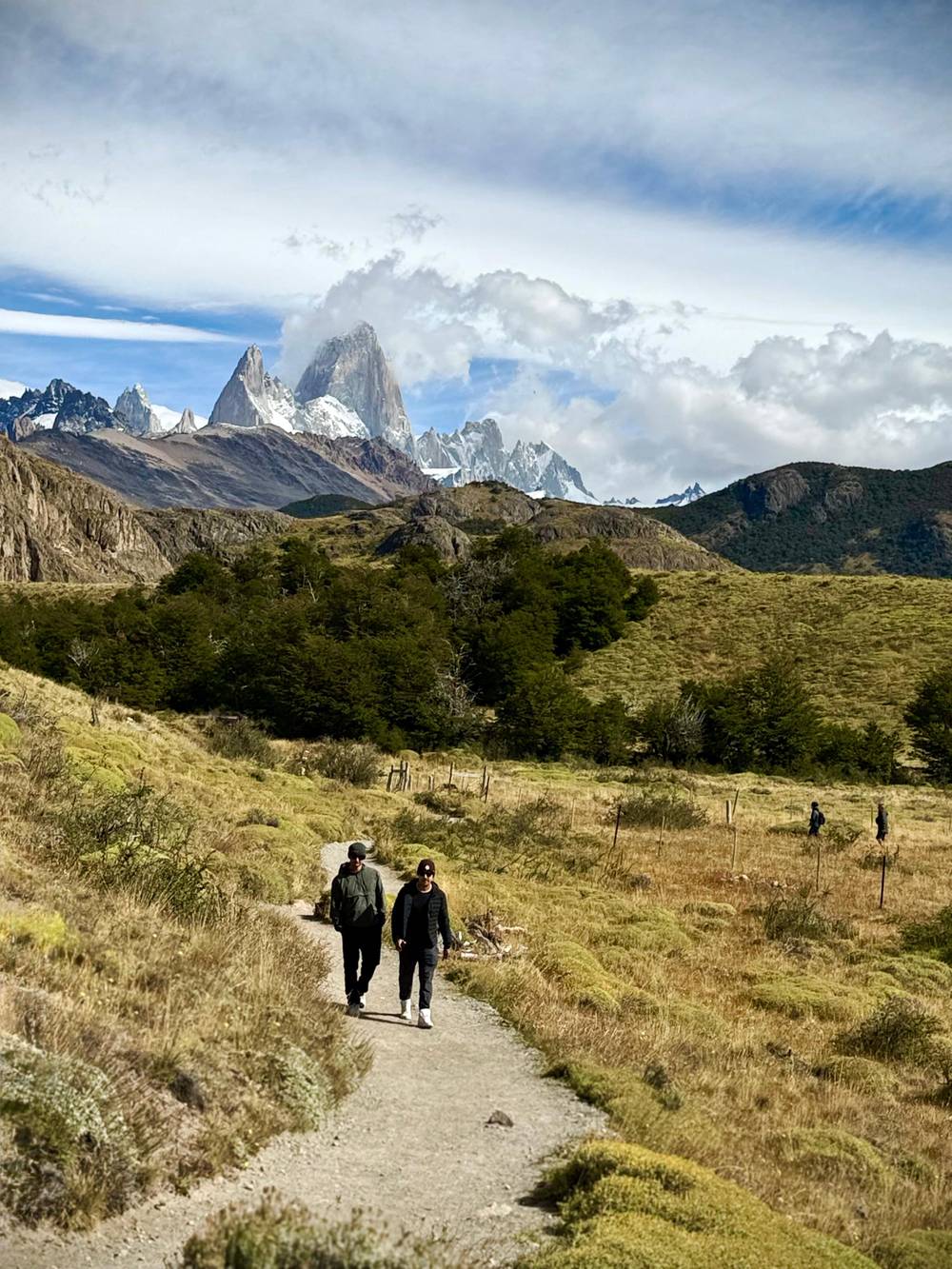
Parking and walking start almost together. The park says its North Zone trails start from the village itself, so once you have parked at your lodging you need the car only for outings such as the Chorrillo del Salto waterfall, which the park leaflet says you can reach by car on Route 41 and a 10-minute walk.10,63
Remember the park ticket. The North Zone charges access fees and its ticket is digital, bought on the web or through a QR code with a card, so a driver arriving with only cash cannot pay at the portal.10,64 Sort it on the phone the evening before, when you still have signal, and keep the confirmation saved offline so a ranger can check it even where the network fails.
FAQ
A private car day lists 3 hours by car each way; coaches list 2.5 hours.
By the park’s count it is 220 km from El Calafate to El Chalten, and every stretch is sealed.1
Studded tyres or approved chains are compulsory on park roads in snow, frost or ice.15
Carry your passport with the entry stamp and a licence that meets Argentina’s conditions.6
The park sets a maximum of 40 km/h on its roads to protect visitors and wildlife.17
Guided days stop at this roadside inn for 30 minutes of coffee and photographs.
Sources
Read next
Tour, bus or car to El Chalten? Ask a real person.